

Maps & Addressing
Vulcan County utilizes geographical information systems (GIS), mapping applications and spatial data sets on a daily basis. Ownership maps are updated each year and are available as a free downloadable PDF or as printed paper maps to purchase from the Vulcan County Administration Office.
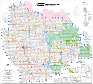
Click HERE for a PDF version of the County’s Ownership Map.
Other spatial data sets include:
- Addressing
- Road Networks
- School Divisions
- Assessment Information
- Current and Historic Air Photos
- Signage Inventories
- Fire and Recreation Districts
- Land Parcel Boundaries
- Road Project information
- Places of Interest
- Oil and Gas Locations
- Bridges and Culverts Inventory
- Electoral Divisions
There are many other PDF maps available within our Map Room. Spatial datasets such as Addresses, Roads, and Places of Interest are available on AMDSP’s AMOS website http://amdsp.ca/amos.html.
Click the links below to view: